JIS University JIS University

Department of Earth Science and Remote Sensing

Home » Academics

Remote Sensing & GIS

School of Sciences

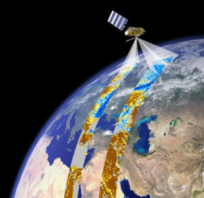
Today, the world is being monitored day and night constantly by high resolution sophisticated earth resources Satellites. Availability of repetitive and high-resolution remote sensing (RS) data has increased the scope of identifying, monitoring and evaluating constant change of earth surface due to manmade and anthropogenic activities. In spite of having gained international recognition at a very early stage, these technologies are now gradually gaining its momentum in the Indian subcontinent as well. Given the wider applications of the Remote Sensing and GIS and the scarcity of human resource with the knowledge of this technology, JIS University has taken an initiative in 2019 to offer MSc in Remote Sensing & GIS course to the students to enhanced the employability. The diverse qualifications of the faculty members ensure expertise in all facet of Remote Sensing & GIS as well as in various interdisciplinary areas. Department ensures academic flexibility and good deal of faculty-student interaction. We have introduced Choice Based Credit System as per the UGC mandate. Project work and seminar presentation are introduced throughout the course curriculum to get an overview of the ongoing research and recent development in the subject. Faculties strong collaboration with national and international reputed organizations in Europe and Canada will help students for their higher education and research.

M.Sc. in Remote Sensing & GIS

Duration: 2 Years

Eligibility:B.Sc. (Hons.) with at least 50% marks in Electronics/Physics/Mathematics/Geography/ Geology/ Applied Geology/ Geo Physics/ Geo Informatics/ Oceanography/ Environmental Science and Equivalent degree (OR) B.E./ B. Tech in ECE/EE/Civil/ Geo Informatics/ CSE/ Agriculture Engineering/Urban & Regional Planning/ IT (OR) B.Sc., Agriculture/ Forestry/ Horticulture (4 years).

PhD in Remote Sensing & GIS

Eligibility:Postgraduate degree in related discipline.

About the Course

M.Sc. in “Remote Sensing & GIS” is a postgraduate course with duration of 2 years and is divided into four semesters. Out of the four semesters, the first three semesters are devoted to exhaustive course work and the fourth semester has two compulsory elective courses and research project with a mandate to work as a member of a research group in a project in close association with the subject matter experts. This course trains the students to enable them to apply their knowledge and practical training in identification of measures or indicators of system performance and the actions needed to improve or correct performance and relative to the goals of the system. More specifically, it is a field of science and technology.

The objective of this course is to equip the students with the required knowledge and practical training to make them proficient at technologies in-vogue and trains them to take up projects relevant to the industrial needs, the R& D activities and self-employment opportunities. Anyone, either with science or technology background, and is interested in remote sensing and GIS can opt for this course. This course is perfect for the aspirants who see their future in high profile jobs or for ones with a fondness for self-run business can also apply for this course and put themselves in a position where they can make a difference. The students who are able to think, can work collaboratively in teams, have an eye for detail and possess management skills are tailor made for this course.

Facilities

  • The Laboratories are well equipped with modern Image Processing software.
  • High speed internet connection to download high resolution satellite images.
  • Offering several special papers to the students giving priority to this challenging interdisciplinary field of science and technology.
  • Computers with High end processing capabilities.
  • The faculty members have strong collaboration with National and International research organizations. Therefore, student can directly work in national and international projects in their dissertations.
  • The faculty members are from reputed universities and research institutes like IITs, JU, CU etc. They are quite experienced in teaching and very much active in pursuing research. They regularly attend national and international seminars and conferences to present their project outcome.
  • Regular interactive sessions with students through departmental seminar, workshops, and different extracurricular activities.

The demand for Remote Sensing and GIS is increasing day by day in Government and Private sector. The job opportunities for people having knowledge of Remote Sensing & GIS are available in organizations like:

  • PhD/JRF/Research Fellow in different IITs and State Govt Universities and international universities.
  • Space Application Centre (SAC) Ahmedabad.
  • National Remote Sensing Agency (NRSA) Hyderabad.
  • Indian Space Research Organization (ISRO) Bangalore.
  • Indian Institute of Remote Sensing (IIRS), Dehradun.
  • Oil & Natural Gas corporation Ltd (ONGC).
  • Indian Agricultural Research Institute (IARI) New Delhi.
  • Indian Council of Agricultural Research (ICAR) .
  • Ministry of Agriculture and Farmers Welfare, Govt. of India .
  • Regional Remote Sensing Centers (RRSC) .
  • Remote Sensing Centers (RSC) in various states of India.
  • Employment opportunities in various private sector in India and overseas.
  • Digital Image Processing
  • Digital Cartography
  • Natural Hazards and Disasters
  • Glacier Mass Balance
  • Glacier Dynamics
  • Glacier Response to Climate Change in High Mountain Asia
  • Climate Studies
  • Assessment and Management of Natural Resources
  • Watershed Delineation and Water Resource Management
  • Suitability Analysis for Crops and Specific Land Use Features
  • Application of Remote Sensing in Archeology
  • Application of Remote Sensing in floristic environment
To Top
Whatsapp
Apply Now